The Sea at the Edge of the World
The Greenland Sea is a vast body of Arctic water at the top of the world. Remote, ice-bound, and teeming with life, its currents shape the planet’s climate, and its history runs as deep as its waters.

At HX, we’ve been exploring the Greenland Sea since the Heroic Age of Polar Exploration. Even today, it remains one of the most challenging places on Earth to explore. That is precisely the point.
On the great maps of the Age of Exploration, the Greenland Sea was drawn as a place of monsters, with sea serpents coiling around ships and toothed creatures lurking beneath unnamed depths. The Carta Marina of 1539 is among the most vivid, depicting creatures in every margin where direct knowledge ran out. The reality, as it turns out, is more extraordinary still.
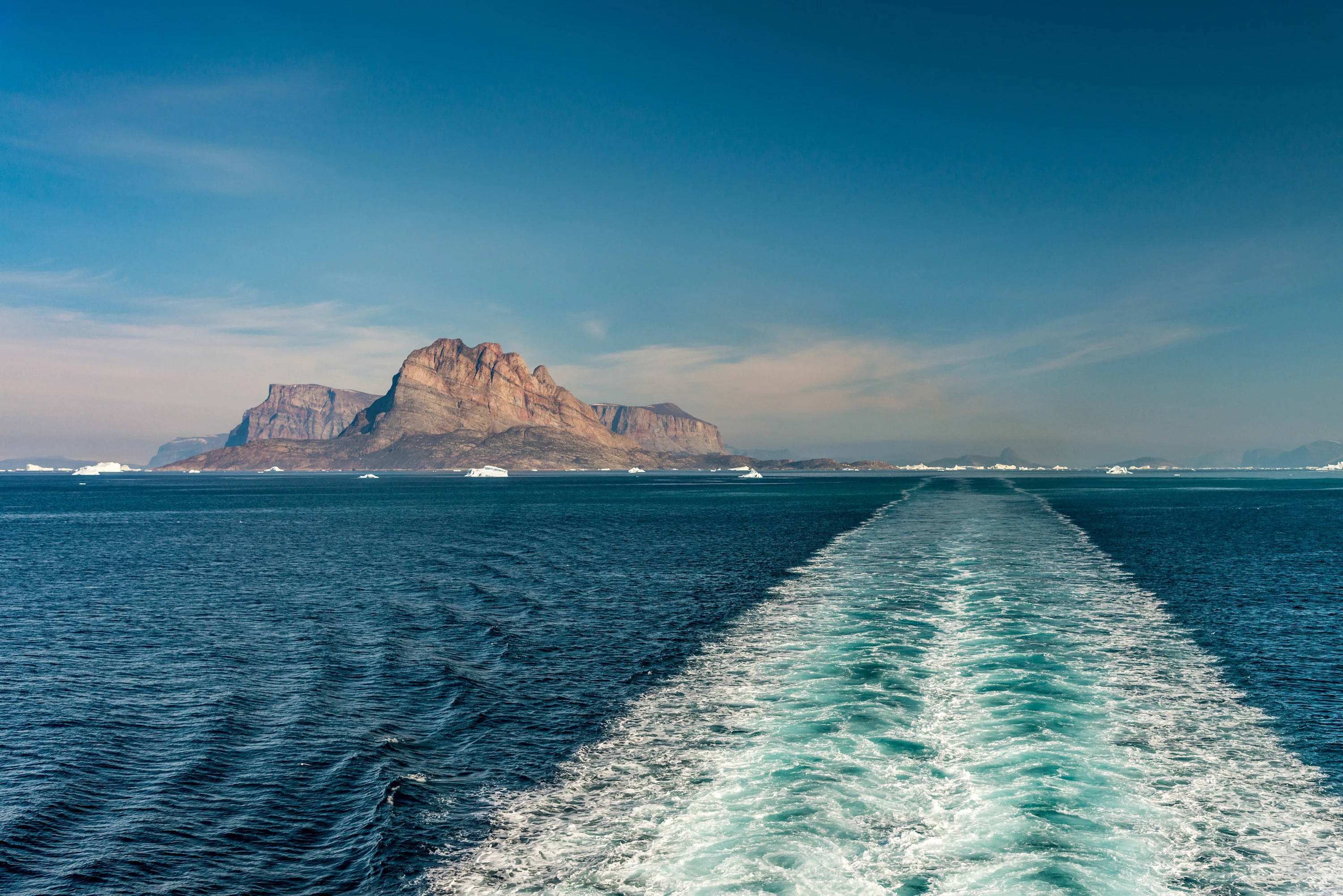
Stretching between Greenland's ice-choked eastern coast, the Svalbard archipelago, and the Arctic Ocean, the Greenland Sea sits above the Arctic Circle in a part of the world that few travellers have reached. From a distance it looks stark and empty, but sail into it and the picture changes completely.

Where the Currents Collide
⠀
To understand the Greenland Sea, you need to understand where it sits, not just on a map, but within the architecture of the planet's oceans. Greenland's ice-laden eastern coast forms its western wall. To the north, Fram Strait opens into the Arctic Ocean: the only deep passage connecting it to the rest of the world's waters. The Svalbard archipelago closes it to the east; to the south, it narrows through the Denmark Strait into the Norwegian and Iceland Seas.
Two great ocean forces collide here: from the west, the East Greenland Current pushes cold, ice-laden Arctic water southward; from the east, warmer Atlantic water flows north along the Spitsbergen Current, keeping Svalbard's western coast, at nearly 80 degrees north, astonishingly mild for its latitude. The boundary between open water and pack ice is not a fixed line but a perpetual negotiation.
⠀
⠀
Something remarkable happens where these forces converge, far beneath the surface and invisible from the deck. Surface water, chilled and dense with salt, becomes heavy enough to sink thousands of metres to the ocean floor in a process called deep water formation, which occurs in only a handful of places on Earth. The sinking here drives the thermohaline circulation, the planetary conveyor belt that moves heat across the Atlantic and shapes climates from Norway to Brazil.
Most of the world's ocean is moved by forces originating elsewhere, but the Greenland Sea is one of the places generating those forces. Beneath a surface that appears still and cold, one of the planet's great engines is running. You are, in this place, at the edge of the world as most of humanity has defined it, and at the beginning of one of the most significant ocean environments on Earth.

In the Wake of the Fram
⠀
Fridtjof Nansen was a Norwegian explorer, scientist, and Nobel Peace Prize laureate. He crossed Greenland on skis when experts said it couldn't be done, redesigned polar equipment based on Inuit methods, and later spent years repatriating refugees across Europe. What set him apart from the explorers who came before him was the discipline he brought to both endeavours.
Nansen was a trained scientist first, and everything he observed in the field, from ocean temperatures to ice behaviour to the limits of human endurance, was recorded with the rigour of a laboratory. But it was one idea, born from wreckage washed up on a Greenland beach, that would define his legacy in these waters.
⠀
⠀
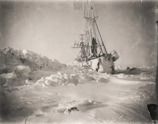
In 1893, he sailed north with a theory so audacious that most scientists dismissed it. Wreckage from the USS Jeannette, crushed by ice off Siberia in 1881, had turned up three years later on Greenland's southwestern coast, carried by a current no one had proved existed. Nansen designed a ship to be frozen into that current and carried across the Arctic Ocean, and he named her Fram, meaning Forward.
For three years, Fram was frozen into the ice and drifted across the Arctic Ocean. Nansen's theory was confirmed, and he himself had walked to within four degrees of the North Pole, farther north than any human had reached. Fram went on to carry Otto Sverdrup into the Canadian Arctic and Roald Amundsen to the South Pole.


Sailing the Fram Strait
⠀
HX ships carry that inheritance across these same waters today. MS Fram bears her name as a statement of purpose: the belief that a ship can be both a platform for discovery and a home for the people who go looking for it. The original Fram, still preserved in Oslo, still holds the title for the furthest north and south any wooden vessel has ever sailed.
When you push through Fram Strait, you are sailing the passage that shaped modern Arctic oceanography, where the cold, the silence, and the particular quality of attention this place demands have remained unchanged since Nansen first described them over a century ago.
⠀
⠀
Aboard MS Fridtjof Nansen, that history becomes something you can inhabit. The 1896 Cabin, built in our 130th anniversary year, reimagines a late 19th-century expedition vessel. More than 20 historically sourced objects line the space: a writing desk, bunk beds, maritime artefacts, a barrel concealing a stocked bar. Oil lamps cast a low glow across wood-panelled walls and a custom scent hangs in the air: salty, timber-warm, unmistakably of that era.
In 1896, the year Fram came home, the men who endured three winters locked in Arctic ice slept in rooms not unlike this one. History, after all, is best remembered when lived.
The People of Kalaallit Nunaat
⠀
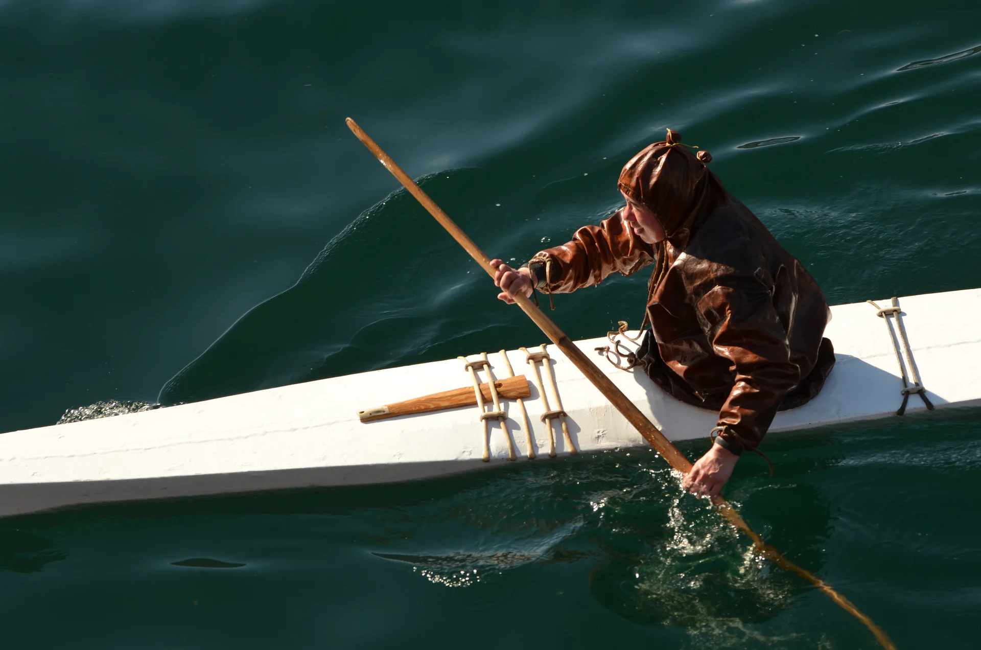
Our Kalaallit: Portraits of Greenland series tells the story of Greenland through the people who shape it. Meet Jacob-Peter, a traditional kayaker; Sara-Marie, a dressmaker; Arnaaraq-Batseba, a village host at the heart of community life; and sisters Aviajaa and Arnaq, who keep the ancient art of Inuit mask dancing alive. Their stories carry the traditions and values that continue to shape Greenland.
The First Peoples
Long before polar explorers named these waters, people had already spent thousands of years learning to live beside them. The first arrivals crossed the Arctic from what is now Canada and Alaska, coming in waves: the Independence people into the far north around 2400 BCE, the Saqqaq along the west coast, and the Dorset after them, each adapting to conditions that defeated every approach from the south.
Around 1000 CE, the Thule people swept east from Alaska in one of the most extraordinary migrations in human prehistory, reaching Greenland within generations. They are the direct ancestors of today's Kalaallit, and carried with them the innovations that would define Arctic life: the qajaq, the toggling harpoon, the dogsled, the semi-subterranean winter house. Where earlier peoples found seasonal footholds, the Thule built a permanent civilisation around the sea.
⠀
⠀
A Civilisation Built Around the Sea
The coastline of Greenland has been inhabited for millennia, with the sea at the centre of it all.
The sea mammals of these shores are not simply wildlife to the communities that live along them. They are food, material, identity, and relationship. The Kalaallisut language encodes this intimacy in ways that cannot be directly translated: individual words for distinct wind patterns critical to navigation at sea, for the particular textures of sea ice that tell a hunter whether it will hold. This is knowledge accumulated over 4,500 years of close attention, and it is as rigorous in its own way as any scientific record.
Ittoqqortoormiit and Scoresby Sund
Ittoqqortoormiit sits on the Greenland Sea coast at the mouth of Scoresby Sund, the fjord system that draws us east each summer. Its hunters have watched these waters across generations, tracking migrations and reading ice with a precision Western science is only beginning to document. This is the heart of our East Greenland expeditions, where the encounter is as much cultural as it is geographical.
Explore our Greenland cultural excursions through the people who shape it.

The qajaq, the Kalaallisut word from which the English ‘kayak’ originated, is perhaps the clearest expression of the relationship between people and sea.
Developed over millennia for hunting in Arctic waters, it was built to fit a single body and move silently through ice-strewn waters. That glove-like fit also makes it possible to perform Greenlandic rolling techniques: precise, instinctive manoeuvres that allow a capsized paddler to right themselves. These are crucial in waters so cold that immersion for even just a few minutes could be fatal.
Greenlandic hunters still build and paddle qajaqs today, and the rolling techniques are still taught and practised in communities along the coast. Explore kayaking in Greenland.
Climate change is now altering the conditions on which this knowledge depends. Sea ice that once held firm enough to travel by dogsled now breaks up unpredictably. The migration patterns that one generation taught the next are shifting. The Kalaallit are among the most informed witnesses to these changes, and those with the most at stake.


The Creatures That Claimed the Cold
⠀
Humpback whales and minke whales move through these nutrient-rich waters, drawn by the profusion of life that blooms each summer when perpetual daylight floods the surface. By May the fjords have largely cleared of ice and the productive season is at its height; June and July offer the best conditions for a prolonged encounter, as feeding concentrates in the nutrient-rich surface waters. A sighting is never guaranteed, but our naturalists keep a careful watch, bringing what's around you into focus.
Beneath all of this visible life, an invisible ecology sustains everything. Phytoplankton and ice algae form the base of the food chain, blooming in extraordinary profusion during the brief Arctic summer. These blooms feed the zooplankton that feed the Arctic cod that feed the seabirds. An entire architecture of life, constructed from cold water and light.
⠀

Under the Midnight Sun
⠀
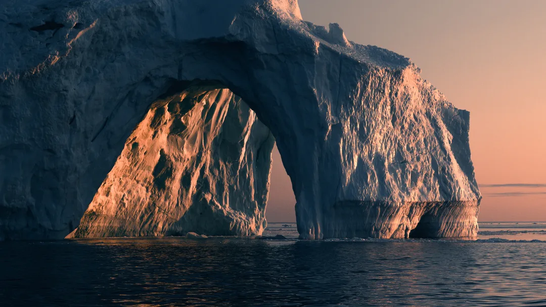
In summer, the sun does not set here but circles the horizon in a low arc, casting the kind of golden, angled light that elsewhere lasts twenty minutes but here stretches through the entire night. Ice becomes a mirror, and the sea shifts through pewter, amber, and rose.
Mountains drop sheer into water, glaciers hold the horizon, and fjords lie so still that their reflections become indistinguishable from the peaks themselves. Over everything, threading through every hour, there is this warm and endless Arctic light that makes the world feel as if it has paused to let you look.
Our expedition teams know the vantage points and the moments: a glacier face catching the low sun, or the chance blow of a whale on a still morning. They read the landscape the way only years of returning can teach. These moments come differently on every voyage, and they never feel routine.
What We Observe, Season After Season
⠀
Water temperatures here are rising at several times the global average rate, and sea ice is retreating at rates unprecedented in at least 1,500 years. As the Greenland Ice Sheet sheds mass, meltwater is diluting the salt-dense water that powers the engine beneath us. If it freshens enough to stop sinking, the consequences reach coastlines thousands of miles from here.
Our ships collect water temperature, CO₂, and microplastics data continuously as they sail, feeding into the datasets that track these changes in real time. Guests participate alongside our onboard science team, logging observations that become part of records outlasting any single voyage.
The knowledge they carry back is something no documentary can replicate: felt rather than merely understood, and personal in a way that changes how you think about what is at stake.

Sail the Greenland Sea
⠀
East Greenland's coast is accessible by ship from August to early September, when the sea ice retreats enough to navigate the fjords. Our expeditions depart from Reykjavík, with voyages ranging from 10 to 15 days depending on how far north you want to reach. Scoresby Sund, the world's largest fjord system, is the centrepiece: an immense network of glaciers, peaks, and Arctic wildlife accessible only by expedition ship.
⠀
⠀
Our expeditions also reach Greenland's west coast, from Disko Bay and the calving glaciers at Ilulissat, to the High Arctic beyond. West Greenland voyages begin in Nuuk, with connecting flights from Reykjavík, Copenhagen, or New York, taking you deeper into the coast by ship from there.


